
The models have been remarkably consistent in showing the spin up of a Medicane in the Ionian region mid week. Usually only the high resolution models are capable of resolving such systems in advance but this time the global models including the ECMWF and the GFS have shown the development of the potential medicane.
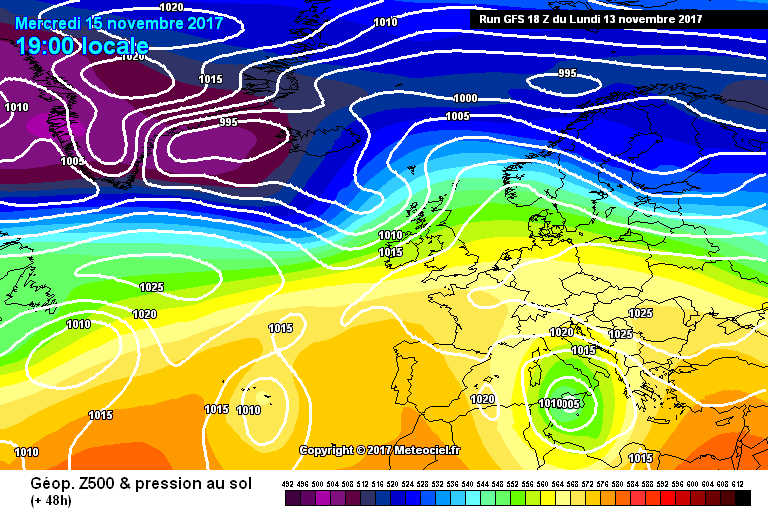
The general situation is shown above in figure 1. A section of the jet stream has driven well to the south into the mediterranean and over north Africa; this will break away leaving a cold core cutoff low. Jet stream breakage over the Balearic or Ionian sea is the most common way to form a Medicane; the initial conditions are characterised by low 500hpa temperatures, high 850hpa temperatures and rapidly reducing wind shear.
Such environments have existed many times before during this season but no TS level medicane has yet been produced. Even ideal environmental conditions do not guarantee the formation of a Medicane. This being said I would say that the probability of formation is relatively high (at least 60%).
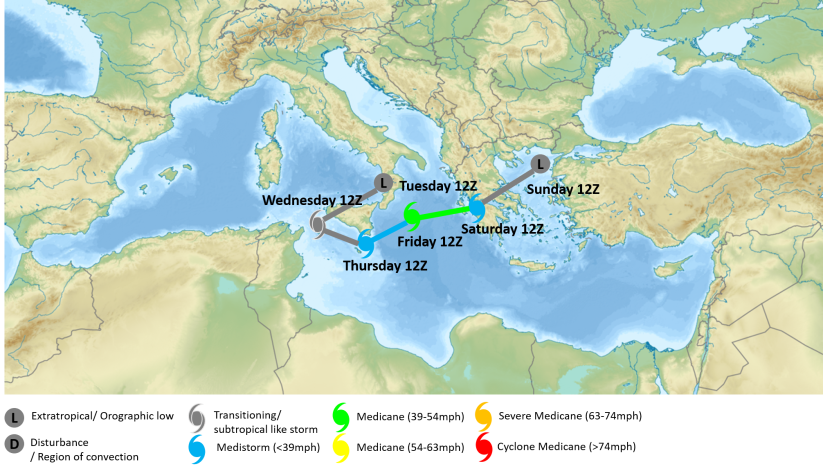
Based on the model output data and my own intuition I have forecast the track of the Medicane in figure 2 (shown above). It is likely the transition from extratropical cyclone to tropical like cyclone will occur either in the Strait of Scicly or in the south east Tyrhhenian on Wednesday. During this period frontal systems to the north and east of the low pressure centre will become increasingly decoupled from the storm. Convection, during this period, will mostly be well to the north east of the centre (and asociated with fronts) however some convection is also likely to develop near the low pressure centre. By Thursday it is expected the storm will be tropical like and have the status of a TD strength medicane (medistorm). From then on it is expected to intensify and move east or north east during Friday. Some models suggest the Medicane will eventually landfall in Greece and although this seems to be the most likely scenario it is highly uncertain. Interestingly enough the storm will follow the path of Medicane Trixie from last year closely. Most Medicanes in the Ionian sea tend to move on a eastward or north eastward track so it isn’t too suprising.

Like the colour-coding for medicane strength- easy spatial and magnitudinal summary.
LikeLike
Realise it’s under construction- are you planning a ‘historical medicane’ section or similar?
LikeLike
Yeh I’m planning to document all medicanes going at least as far back as 2014.
LikeLike